Planning a Responsible Spiti Valley Journey
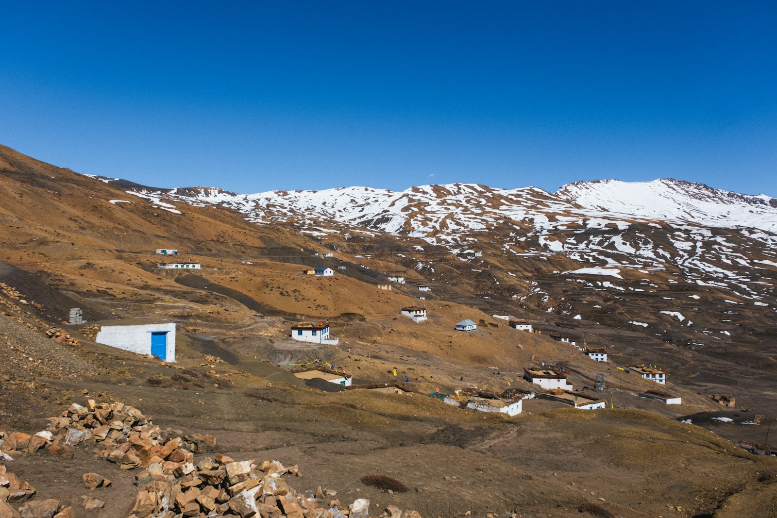
Planning a Responsible Spiti Valley Journey
Spiti rewards preparation more than speed. Long drives on changeable mountain roads, high sleeping elevations, limited services, border-area administration, and small settlements all make a tightly packed checklist itinerary a poor fit. Responsible planning begins by accepting that access is conditional and that a visitor’s convenience does not outrank health, an official closure, or the everyday needs of a host community.
This guide does not offer a supposedly perfect circuit or a guaranteed season. It provides a method: shape the journey around sleeping altitude, verify permits for the exact traveller and route, treat roads as live operational questions, and reduce avoidable pressure on water, waste systems, religious places, and residents.
Key Takeaways
- Plan by sleeping altitude, not only kilometres. A short drive can still produce a large elevation gain, so build in staged ascent, lighter early activity, rest, and room to change plans.
- Check permits for the exact person and itinerary. Nationality, route, and specific places matter; read the current MHA PAP/RAP rules first and use currently published district contact channels only when those rules leave an itinerary-specific question unresolved.
- Treat every road plan as conditional. A district road-status link is a checking point, not a promise that a pass, highway, village road, or side trip will be open on a chosen date.
- Make turning back part of the plan. Buffer days, fallback accommodation, fuel and food margin, and refundable arrangements are safety tools rather than signs of poor planning.
- Travel as a guest. Conserve scarce resources, carry difficult waste onward, ask before photographing people or religious interiors, obey signs, and do not enter restricted areas.
Build the Itinerary Around Sleeping Altitude
Distance is an incomplete way to design a Spiti journey. The CDC Yellow Book explains that altitude risk is strongly shaped by the elevation at which a traveller sleeps and the rate of ascent. It also makes an important corrective to a common assumption: physical fitness does not confer immunity from altitude illness. A strong runner can still become unwell after ascending too quickly.
Begin with a table listing each proposed overnight stop and its sleeping elevation, then discuss the pattern with a qualified travel-health clinician when personal circumstances warrant it. The purpose is not to force every person into one universal schedule. It is to identify abrupt gains, remove pressure to “complete” a circuit, and create real acclimatisation time. Keep early days lighter and avoid treating a strenuous excursion as proof that the body has adjusted.
A responsible plan also has exit options. Record where the group could pause, descend, or obtain assistance if someone becomes unwell. Do not ascend with worsening symptoms. Severe symptoms require urgent assistance, not another night added to a sightseeing plan. The CDC source provides detailed clinical warning signs, but an article cannot diagnose a traveller or recommend medication and dosage. People with relevant medical conditions, a history of severe altitude illness, pregnancy, or medication questions should seek individual clinical advice before departure.
Verify PAP and RAP Requirements Precisely
Permit discussions around Spiti often collapse several terms into “inner-line permit.” That shorthand can obscure who needs which authorisation and where. The Ministry of Home Affairs uses Protected Area Permit (PAP) and Restricted Area Permit (RAP) in its Foreigners Division material. District Kinnaur’s Tourist Guidelines also use local tourism terminology while explaining that notified areas between the inner line and international border receive special treatment.
The practical rule is simple but route-specific: never publish or rely on a blanket claim that “Spiti requires a permit” or “Spiti is permit-free.” Requirements can depend on nationality, the road taken, and the settlements or border areas included. An itinerary through Kinnaur may raise different questions from another approach, and a side trip can matter even when the main destination sounds familiar.
Before paying for inflexible arrangements, open the current MHA PAP/RAP hub and check the complete itinerary—not just “Spiti”—against the published rules. Use contact channels currently published by the relevant Kinnaur or Lahaul-Spiti district authority, and request clarification when the official material does not resolve a traveller’s nationality, route, or destination. Repeat the check shortly before travel. Do not reproduce old fees, group-size rules, exemptions, or issuing-office lists from dated pages. Carry required identification, respect checkpoints, and never improvise a detour around a restriction.
Treat Roads and Weather as Live Information
The Lahaul-Spiti district portal links visitors to road status, disaster-management information, helplines, and health facilities. Use those as starting points for a fresh check. The homepage’s general description of regional connections is not evidence that Kunzum Pass, the Manali–Kaza road, the Kinnaur approach, Chandratal access, or a village side road is open now.
Mountain access can change because of snow, rain, landslides, rockfall, water crossings, maintenance, construction, or an administrative order. A road reported open yesterday can be delayed today; a line on a map cannot show a new obstruction. Check dated district and disaster notices shortly before each travel day, then obtain route-specific confirmation from the responsible authority or operator. Local accommodation can help describe the final approach, but an informal assurance never overrides police barriers or official closures.
Design the booking around uncertainty. Keep buffer days at both ends, avoid a same-day connection that depends on a long mountain drive, and identify fallback lodging before departure. Carry enough food, drinking water, essential medication, charging capacity, and fuel margin for delay without stripping supplies from a small settlement. The driver must be free to wait or turn back. No photographed milestone, prepaid room, or onward ticket is worth continuing into a closure or rapidly deteriorating conditions.
Prepare for Health Without Self-Prescribing
Altitude preparation starts before the journey but should remain conservative. Read the CDC guidance to understand why sleeping altitude and ascent rate matter, and seek clinical advice appropriate to the traveller rather than copying another person’s medication plan. Prescription drugs can have contraindications and cannot substitute for a sensible ascent profile.
During the trip, make symptom reporting easy. Agree that nobody will hide a headache or worsening condition to protect the schedule, and that the group will not shame a person who needs to stop. Keep activity light after significant gains and avoid using fitness, age, prior trekking, or one symptom-free night as a guarantee.
Know how to contact assistance and how a descent would work from each overnight stop. Communications and transport may be limited. The response to serious deterioration is urgent help and movement to safer altitude under appropriate guidance, not online diagnosis. A plan that cannot tolerate a rest day or retreat is not ready for high-altitude travel.
Reduce Pressure on Water, Waste, and Settlements
Low-impact choices should be described honestly as editorial responsible-travel recommendations, not invented local law. Bring refillable bottles and reusable containers where practical, avoid unnecessary layers of packaging, and carry waste that cannot be responsibly handled locally to a suitable disposal point. Do not burn rubbish or leave it beside an overflowing bin. Conserve water, especially for washing, and ask hosts what their system can support.
Buy meals, accommodation, transport, and guiding services locally where they fit the itinerary, but avoid claiming that every business is environmentally certified. Smaller groups can be easier to host and transport than convoys. Confirm meals and rooms rather than arriving with expectations that a household or monastery will absorb an unannounced group.
Keep vehicles to roads and legal parking areas. Walking a few extra minutes is preferable to blocking access or damaging ground. Carry personal essentials so delays do not create an avoidable burden, while still listening to local businesses about what should be purchased locally and what supply constraints exist.
Respect Villages, Monasteries, and Restricted Places
A beautiful place is not automatically a public backdrop. Ask before photographing a person, home, ceremony, religious interior, or object. Permission to enter does not necessarily include permission to film or publish. Follow signs, remove shoes or cover yourself when requested, keep voices low, and accept a refusal without debate. Customs vary by institution and settlement, so ask rather than turning one encounter into a rule for all Spiti.
District Kinnaur’s guidance identifies security and photography restrictions in notified areas. Do not photograph security installations, checkpoints, or anything marked restricted. Stay on permitted routes and follow instructions from authorities. Drone use, professional filming, and access to sensitive places may involve rules not established by this dossier; verify them with the competent authority rather than assuming that ordinary camera access extends further.
Wildlife and livestock also deserve distance. Do not feed, chase, surround, or stage animals for photographs. Keep noise low and follow local or protected-area instructions. Responsible travel is less about collecting every viewpoint than leaving daily life, sacred space, and habitat undisturbed.
Make a 48-Hour Recheck
Two days before departure, revisit the plan as if no booking were guaranteed. Recheck the current MHA PAP/RAP rules for every traveller and the exact itinerary; where those rules remain unclear, use the contact channels currently published by the relevant district authority to request clarification. Open the latest district road and disaster information; check the forecast; reconfirm the final approach with accommodation and transport providers; and note any closure or restriction.
Review overnight elevations, health consultations, essential medication, emergency contacts, identification, cash and payment contingencies, fuel, food, water, warm layers, sun and rain protection, and charging. Share the route and check-in plan with a trusted contact. Make sure every traveller knows the fallback accommodation and conditions that will trigger a delay, shorter route, descent, or cancellation.
Then keep checking. A responsible Spiti journey is not the itinerary that covers the most ground. It is the one that protects health, follows current rules, adapts to the mountain, and leaves communities with as little avoidable pressure as possible.
Frequently Asked Questions
Does every visitor need a permit to travel in Spiti Valley?
No blanket answer is safe. Requirements depend on nationality, the exact route, and the places visited. Check the current Ministry of Home Affairs PAP/RAP rules first; if they do not resolve the itinerary, use contact channels currently published by the relevant district authority to request clarification before departure.
Is an Inner Line Permit the same as a Protected Area Permit?
District tourism material may use “inner line permit” colloquially, but PAP and RAP are the formal terms used by the Ministry of Home Affairs. Do not assume the labels are interchangeable or that an old online procedure applies to your nationality and route.
What is the safest route or month for a Spiti trip?
No route or month can be guaranteed safe. Snow, rain, rockfall, water crossings, construction, and official closures can change access quickly. Check current district road and disaster notices, keep buffer days, and retain a practical fallback plan.
Does being physically fit prevent altitude illness in Spiti?
No. The CDC notes that fitness does not eliminate altitude-illness risk. Plan gradual gains in sleeping altitude, keep early activity light, and discuss personal risks or medication questions with a qualified clinician before travel.
How can a visitor reduce pressure on Spiti communities?
Travel with a flexible, modest itinerary; conserve water; refill and reuse where practical; carry difficult waste to a suitable disposal point; ask before photographing people or interiors; obey restricted-area signs; and favour locally run services without assuming any business is environmentally certified.