Solan District
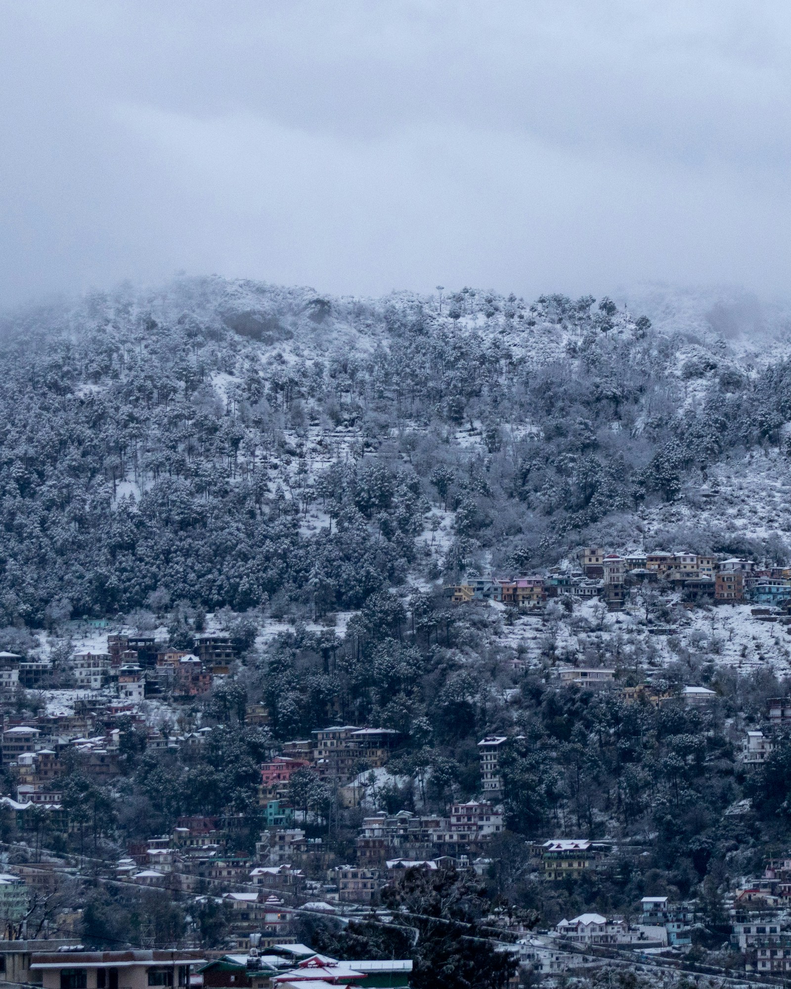
Solan District
Solan is a modern administrative district whose component places had different histories before they were joined. The unit came into existence on 1 September 1972. Earlier evidence concerns hill states, settlements, cantonments, schools, railway corridors, tahsils, or larger provincial districts; it does not describe one ancient Solan with today’s outline. Continuity of a name or locality is not continuity of a boundary.
That distinction gives the district a clearer history. A colonial gazetteer records separate hill-state jurisdictions. Later official accounts identify a cantonment and an institution founded in the nineteenth century. A railway nomination describes a route constructed across the turn of the twentieth century. A statute controls the 1966 interstate transfer of Nalagarh, while retrospective district and Census histories explain the different 1972 act of district formation. Each record answers a particular question and should not be made to answer all of them.
Key Takeaways
- Modern Solan is an administrative composite. Its 1972 boundary joined tehsils whose earlier affiliations included Mahasu, Shimla, Ambala, Punjab, and former hill states.
- The predecessor states remained distinct units in the colonial record. Their separate treatment does not prove exact overlap with the present district or a single timeless culture.
- Cantonments, Sanawar, and the railway formed an institutional layer. They created named nodes and a transport corridor before a district called Solan existed.
- Transfer preceded formation. Parliament moved Nalagarh tahsil in 1966; Himachal Pradesh’s later reorganisation assembled Solan district in 1972.
- Heritage records have narrow authority. A World Heritage decision establishes recognition of a railway property, while a protected-monuments inventory establishes listed status rather than age, patronage, or legend.
Separate Hill-State Jurisdictions
The Simla Hill States Gazetteer of 1910, printed in 1911, provides a useful early-twentieth-century administrative view. Its contents and dedicated sections treat Nalagarh, Keonthal, Baghal, Bhagat/Baghat, Kunihar, Mahlog, Kuthar, Mangal, Beja, and Koti separately. The list matters because it resists the temptation to give the later district a single princely predecessor. These were distinct gazetteer units, not chapters in an already unified Solan.
The same list has firm limits. A gazetteer section does not prove that all territory attached to a former state lies inside the current district, or that a modern boundary reproduces a colonial one. Nor does separate official treatment make colonial classifications neutral. The volume was prepared for government administration and carries the categories and biases of its period. Its degraded text recognition also makes unverified quotation unreliable. The defensible conclusion is limited: several separately described jurisdictions contributed to the historical setting from which modern Solan emerged.
The 2011 District Census Handbook supplies a later administrative synthesis. It places several former hill-state components in the chain that led through Mahasu district. Nalagarh followed another route: from a former state into the Patiala and East Punjab States Union, then Punjab, where it became a tahsil of Ambala district. These sequences changed the jurisdictions above local places; they do not demonstrate unchanged territory below them.
This mosaic is more than a list of names. It explains why an event in Nalagarh cannot automatically stand for Arki, Kandaghat, or Solan, and why one courtly or institutional narrative cannot represent every place within the present outline. The district’s history begins with plurality, followed by successive administrative combinations.
Cantonments and Sanawar, 1847–1849
A second layer appeared through colonial military and institutional sites. The current district administration dates the founding of Dagshai Cantonment to 1847 and says that five villages were obtained from the Maharaja of Patiala for its formation. The same later official account dates construction of Dagshai’s Central Jail to 1849. These dates are useful when kept attributed to the district portal rather than presented as if they came from contemporary deeds or building records.
The portal also identifies Kasauli within the cantonment landscape. That supports naming it as another colonial node, but not assigning it an exact foundation year here. Dagshai and Kasauli show that military administration marked particular localities in the territory later assembled as Solan. They do not establish that every part of the modern district experienced cantonment rule in the same way.
The district page itself warns that no authenticated record establishes the origin of Dagshai’s name. An etymological story would therefore add no reliable chronology and is not needed to understand the cantonment. The supported history rests on the attributed 1847 formation account and the 1849 jail date, not on a legend.
Sanawar belongs to the same broad period but a different institutional category. The Lawrence School’s own historical account says that Sir Henry Lawrence founded the school at Sanawar in 1847. That is appropriate evidence for how the institution records its foundation. It does not establish a claim of precedence, describe the experience of nearby residents, or make the school representative of education across the later district. Cantonment, jail, and school should remain distinct nodes rather than becoming one generalized story of colonial society.
A Railway Corridor at the Turn of the Century
The Kalka–Shimla Railway added a transport line across this already varied landscape. The Indian state-party nomination describes it as a 96.6-kilometre, single narrow-gauge route between Kalka and Shimla. Its chronology places construction across the late nineteenth and early twentieth centuries and records the line’s opening in 1903. This establishes a route-wide engineering and transport sequence before Solan district existed.
Route-wide evidence requires geographic restraint. The nomination does not place every bridge, tunnel, station, or other feature inside today’s Solan district. A total for the railway cannot be converted into a district inventory, and the line’s presence does not by itself prove a uniform economic or social effect for households along it. The railway is best understood here as a corridor crossing multiple jurisdictions and local settings.
The route also illustrates how later district history can contain older infrastructure without absorbing all of its meaning. Its endpoints, management, and engineering history belong to a system larger than Solan. Within a district profile, it marks the expansion of colonial transport through selected places and connects the cantonment and institutional layer to a wider mountain railway. It does not supply a founding event for the district.
Nalagarh and the 1966 Transfer
Post-independence reorganisation brought Nalagarh along a path different from the principal Mahasu components. The Census handbook traces Nalagarh from its former-state setting through the Patiala and East Punjab States Union and into Punjab. There it was administered as a tahsil of Ambala district. The other principal pieces that would later enter Solan district came through Mahasu and, after further reorganisation, the Shimla chain.
The controlling evidence for the interstate change is the Punjab Reorganisation Act, 1966. Its appointed day is 1 November 1966, and section 5 moves Nalagarh tahsil of Ambala district from Punjab to Himachal Pradesh. The legal unit matters. Parliament did not transfer “Solan district,” because that district did not yet exist, and the Act did not move the whole collection of territories that would be assembled six years later.
The Act therefore marks a change in Nalagarh’s higher jurisdiction, not the birth of Solan. It provides primary legal authority for the date and transferred tahsil, while the Census handbook helps explain Nalagarh’s preceding administrative route. Neither record makes Nalagarh’s history interchangeable with that of the tehsils approaching 1972 through Mahasu and Shimla.
Between 1966 and 1972, the relevant units belonged to the administrative setting from which the later district would be drawn. The surviving summaries do not establish every intermediate adjustment, so a detailed year-by-year boundary reconstruction would go beyond their support. The durable sequence is enough: Nalagarh crossed the interstate boundary in 1966; district formation followed in 1972.
Four Tehsils and a New District in 1972
The district administration and the Census handbook agree that Solan district came into existence on 1 September 1972. They describe its composition as Solan and Arki tehsils of the then Mahasu district, together with Kandaghat and Nalagarh tehsils of the then Shimla district. The four-tehsil formula is the clearest supported account of the new unit’s formation.
This was an administrative assembly, not recognition of an ancient district waiting to be restored. Solan and Arki reached the new arrangement through Mahasu, while Kandaghat and Nalagarh were taken from then Shimla; Nalagarh itself carried the additional Punjab and Ambala sequence behind it. The new boundary placed those differing histories within one district administration without making their earlier jurisdictions identical.
The evidence category remains important. The two accounts are official retrospectives, and the underlying 1972 Gazette order has not been recovered. Their agreement supports the date and composition, but they should not be described as the primary formation law. That is different from 1966, for which the parliamentary Act is available. Keeping those authorities separate prevents a later summary from acquiring statutory force it does not possess.
The date also changes how earlier evidence should be phrased. Dagshai, Kasauli, Sanawar, Nalagarh, Arki, Kandaghat, and Solan had histories before 1972, but none proves a continuous district-wide institution. After formation, they shared a new administrative frame; before it, connections must be described through the particular jurisdictions, institutions, and routes that the sources document.
Heritage Recognition and Material Evidence
In 2008, the World Heritage Committee adopted Decision 32 COM 8B.25, approving the Kalka–Shimla Railway as an extension of Mountain Railways of India. This was a heritage decision about a serial property, separate from the nomination’s account of construction and the 1903 opening. It does not relocate each railway feature into Solan or establish effects on local society.
The Archaeological Survey of India’s national inventory works at another scale. Its Himachal Pradesh section is organized by monument or site, locality, and district. Such an entry can establish that a named place has centrally protected status; it cannot by itself prove the site’s age, patron, dynasty, associated event, or legend. No individual Solan row is used here, so no protected monument is named or assigned a history on the inventory’s authority.
These limits are constructive. A railway nomination, a World Heritage decision, and a protected-sites list are all heritage records, but they answer different questions. The nomination describes the route and chronology, the Committee records recognition in 2008, and the inventory records site-level legal status. None is a substitute for a complete local history.
Reading Solan as a Composite
Solan’s historical coherence lies in assembly rather than ancient continuity. Separate hill-state jurisdictions supplied one layer; cantonments and Sanawar added military and institutional nodes; the railway crossed the region as part of a longer route; and post-independence reorganisation moved different tehsils through different administrative chains. The 1972 district brought those strands together.
That interpretation preserves both connection and difference. It allows Dagshai’s attributed dates, Sanawar’s institutional foundation, the railway’s 1903 opening, Nalagarh’s 1966 transfer, and the four-tehsil formation of 1972 to stand in one chronology without pretending that they describe the same territory or kind of event. Modern Solan is therefore not a timeless container for every earlier claim. It is the administrative result of histories that met within a new boundary on 1 September 1972.
Frequently Asked Questions
Was modern Solan one continuous political unit before 1972?
No. Earlier records describe separate hill states, provincial districts, tahsils, cantonments, and institutions. Their territories and boundaries changed, and the current district was assembled only on 1 September 1972.
Which predecessor units does the Simla Hill States Gazetteer treat separately?
Its contents separately treat Nalagarh, Keonthal, Baghal, Bhagat, Kunihar, Mahlog, Kuthar, Mangal, Beja, and Koti. That list shows distinct gazetteer units; it does not prove that each matched or lay wholly inside modern Solan.
What happened to Nalagarh on 1 November 1966?
The Punjab Reorganisation Act transferred Nalagarh tahsil of Ambala district from Punjab to Himachal Pradesh. It did not create Solan district or transfer every component that would later form the district.
When was Solan district formed and from which tehsils?
Official retrospective accounts date formation to 1 September 1972 from Solan and Arki tehsils of then Mahasu district and Kandaghat and Nalagarh tehsils of then Shimla district. The underlying formation order has not been recovered, so this is not presented as primary statutory evidence.
What do the available records establish about Dagshai and Sanawar in 1847?
The district administration dates Dagshai Cantonment to 1847 and says five villages were obtained from the Maharaja of Patiala; it dates the jail to 1849. The Lawrence School's institutional history dates its Sanawar foundation to 1847 under Sir Henry Lawrence. Both are attributed accounts with narrower authority than contemporary founding records.