Mandi District
Mandi District
Mandi district is best understood from its clearest administrative turning point. On 15 April 1948, the former princely states of Mandi and Suket were amalgamated to form the present district, as Himachal Pradesh itself was formed. The modern unit therefore did not simply continue an ancient territory under a new label. It brought two separately documented hill states into one district administration.
Working backward from that date reveals a layered record rather than a seamless origin story. Official retrospectives preserve several explanations for the name Mandi, an inscription reference, and a dynastic attribution for the consolidation of the town. Early twentieth-century gazetteers document Mandi and Suket separately while also showing how administrative histories were assembled. A later heritage inventory confirms central protection for four named entries, but not the dates, patrons, or condition of those monuments. These sources are most useful when each is asked only the kind of question it can answer.
Key Takeaways
- The present district dates from 15 April 1948. It was formed by amalgamating the former Mandi and Suket states; no legal instrument or notification is inferred from the retrospective account.
- Mandi and Suket had separate political and documentary identities. Their histories should not be collapsed into one dynasty or projected backward from the modern boundary.
- The name has attributed alternatives. Mandav, the Hindi word for “market,” and Sanskrit mandapika appear as tradition, lexical explanation, or conjecture rather than a settled etymology.
- Inscriptions and monuments require narrow claims. The Census handbook’s dates and Ajber Sen attribution are retrospective, while the ASI list establishes protected status only.
- The 1846 and 1948 changes were different. The handbook describes a transition to British control and Jalandhar supervision in 1846; the district itself followed through amalgamation in 1948.
Two States Before One District
Before 1948, Mandi and Suket were distinct princely states. The distinction is visible not only in later Census language but also in the existence of separate administrative volumes: Panjab Gazetteers Mandi State 1920 and B. R. Beotra’s A Gazetteer of the Suket State of 1927. Separate books do not define every boundary or explain every relationship, but they prevent the modern district from being mistaken for a single earlier state.
The official District Mandi history presents the two states as rivals whose histories included wars with one another and with adjoining states. That is useful as an attributed institutional memory, not proof of constant hostility. Without dated cases and evidence from both sides, “rivalry” cannot carry a continuous military narrative. Political competition, accommodation, and changing external authority may have taken different forms over time.
Dynastic traditions also need to remain state-specific. In the Mandi narrative, the 2011 Census handbook foregrounds Ajber Sen, attributing to him the consolidation of Mandi territory and establishment of the present town at about 1500. That is an official retrospective attribution, not an uncontested foundation date. Suket has its own documented dynastic treatment in the 1927 Gazetteer, but the surviving ruler table is too damaged to support exact names, accessions, genealogies, or a founding sequence. The absence of a reproduced list is not evidence that Suket lacked a dynastic history; it is a limit on what can safely be stated from this record.
The Suket Gazetteer’s method adds another caution. Its compiler says the volume drew on earlier Mandi and Suket gazetteers, state reports, census reports, and political-history material. Repetition across such works may therefore reflect shared inputs rather than independent confirmation. The separate volume establishes Suket’s documentary identity, while its compilation history warns against treating administrative books as multiple eyewitnesses.
Names, Traditions, and Early Evidence
The name “Mandi” has more than one explanation in the official record. One account associates it with the sage Mandav. Another connects it with the Hindi word mandi, meaning “market”; the 1920 Mandi State Gazetteer also gives this lexical meaning. The Census handbook additionally notes a possible relationship with Sanskrit mandapika and conjecturally links the market explanation to an old trade route.
These are alternatives, not steps in a proved derivation. The Mandav association belongs to the history of tradition. “Market” is a supported meaning of the Hindi word, but that does not by itself prove why the place received its name. The mandapika connection is explicitly a possibility. A credible history preserves all three categories without selecting whichever produces the smoothest story.
The 1920 Gazetteer is unusually candid about the difficulty of early chronology. It says that reliable Mandi history “in the modern sense” was lacking before Sikh rule and identifies genealogical rolls, monuments, coins, inscriptions, and scattered materials among the evidence available to its compilers. That admission matters as much as any ruler list. It shows that an administrative narrative was assembled from evidence of different kinds and reliability, not read from one continuous contemporary record.
The Gazetteer’s warning should itself be contextualized. It is a colonial administrative publication, shaped by government purposes and the historical standards and assumptions of its period. Genealogy, material remains, and inscriptions can preserve important knowledge, but they do not automatically corroborate one another. Nor does a colonial compiler’s judgment decide the value of local memory. The useful conclusion is narrower: early Mandi history survives through layered evidence that requires attribution and comparison.
Inscriptions, Town Attributions, and Protected Monuments
The Census handbook identifies an inscription at Triloknath temple in old Mandi as the earliest record of the town that it mentions, dating it to Saka 1442/AD 1520. This is an official retrospective reference to an inscription, not a fresh transcription, translation, or epigraphic assessment. It supports saying what the handbook reports. It does not authorize additional claims about the inscription’s wording, patron, purpose, or the age of every structure at the site.
The same handbook attributes the consolidation of Mandi territory and establishment of the present town about 1500 to Ajber Sen, and places the Bhutnath and Triloknath temples in his reign. These statements belong to its retrospective dynastic and urban narrative. “About 1500” should not be sharpened into a precise foundation year, and the temple associations should not be presented as uncontested archaeological dating. The handbook’s town account and inscription reference are related historical waypoints, but neither substitutes for a building survey or a new reading of the stone.
The Archaeological Survey of India’s Himachal Pradesh inventory supplies a different kind of evidence. Its Mandi entries are Ardhanariswara Temple and adjoining land, Barsela Monuments, Panchvaktra Temple, and Temple of Trillokinath. The spelling “Trillokinath” is the inventory’s own form; it need not be silently harmonized with “Triloknath” in the Census account.
Central protection is a current documentary status attached to those listed entries. It confirms that the ASI inventory includes them; it does not establish their construction dates, patrons, architectural phases, ownership, religious practice, condition, or current access. The list also cannot decide whether a retrospective ruler attribution is historically correct. Keeping inscription, dynastic account, and protected status separate allows the material record to anchor the history without asking it to prove more than it does.
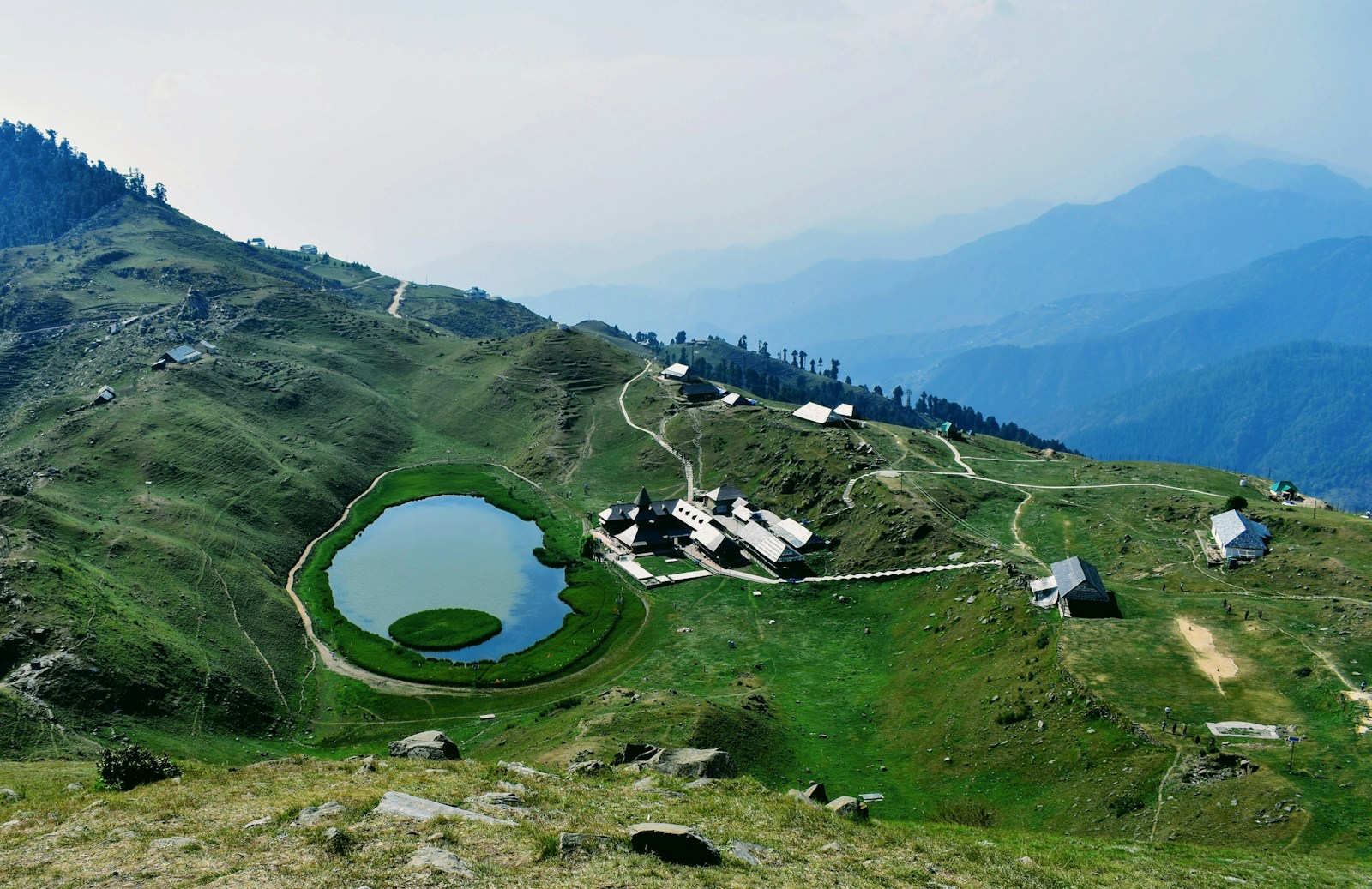
The Prashar Lake image accompanying this profile belongs to another category again. It is a present-day geographic view of the district, not evidence for an early polity, a town foundation, a temple chronology, or the 1948 boundary. Visual context can locate readers in Mandi’s landscape while remaining outside the proof for historical claims.
The 1846 Transition in the Census Account
The Census handbook describes a major political change after the 9 March 1846 British–Sikh treaty. In its account, the cession of the Satluj–Beas doab brought Mandi and Suket under direct British control, and both were placed under the Commissioner of Jalandhar. This is the handbook’s retrospective summary of the transition; the treaty itself has not been independently inspected for this account.
That qualification affects wording, not the importance of the change. The 1846 passage describes British authority and Jalandhar supervision over both states. It does not turn Mandi and Suket into one state, erase their separate political and documentary identities, or establish that administration changed uniformly in every locality. “Under British control” follows the handbook’s formulation and should not be expanded into an unsupported claim about annexation, treaty clauses, or day-to-day governance.
The source sequence also deserves scrutiny. The 1920 and 1927 gazetteers were products of the administrative world that followed this transition. They preserve details and source traditions that might otherwise be difficult to locate, but they also classify the hill states for governmental purposes. Reading them historically means using their descriptions while recognizing the priorities, inherited materials, and asymmetries behind their compilation.
15 April 1948: From Two States to One District
The firm administrative hinge comes more than a century later. The Census handbook states that the present Mandi district was formed on 15 April 1948 by amalgamating the former princely states of Mandi and Suket, when Himachal Pradesh was formed. This is the appropriate anchor for claims about the district as a unified administrative unit.
Amalgamation joined earlier jurisdictions; it did not prove that their histories had always been one. Mandi’s town traditions, Ajber Sen attribution, inscription reference, and dedicated Gazetteer belong first to the history of Mandi State and its capital. Suket’s separate Gazetteer establishes another documentary stream. The 1846 transition placed both within a shared framework of British control according to the handbook, but they remained distinguishable predecessors until 1948.
The date is clearer than the mechanism available here. No merger agreement, Gazette notification, territorial schedule, or other legal instrument has been established from the available sources, so none should be invented or implied. The Census handbook is strong official-retrospective support for the date and the two predecessor states, not primary statutory proof of every procedural step.
This distinction also prevents later boundaries from being projected backward. A monument now listed in Mandi district need not have belonged to a political unit with the same outline in 1520, 1846, or 1927. Likewise, a tradition recorded under one former state cannot automatically represent the other. District formation created a common administrative frame within which these histories are now read; it did not erase their different provenance.
The modern district’s historical significance lies precisely in that convergence. In the Census handbook’s retrospective account, Mandi and Suket entered a shared framework of British control in 1846 while retaining distinct princely-state histories and documentary traditions; they met in the administrative act remembered on 15 April 1948. The strongest narrative is therefore not one of timeless unity but of a documented amalgamation.
Reading Mandi’s Layered Past
Mandi’s history becomes more precise when certainty is matched to source type. The Census handbook provides the principal retrospective chronology: naming alternatives, the Triloknath inscription reference, the Ajber Sen account, the 1846 transition, and the 1948 formation. The Mandi Gazetteer exposes the fragility of early history and the evidence categories used to assemble it. The Suket Gazetteer provides a separate administrative account of Suket and reveals its dependence on earlier compilations. The ASI list records protected status for four exact entries.
None of these sources is a complete social history. They say much more about rulers, administrative transitions, monuments, and official classification than about how households in different valleys experienced political change. They also do not support a complete ruler sequence, a firm origin date for either state, detailed battle narratives, or present-day claims about monument condition and access.
The evidence nevertheless supports a coherent account. Mandi and Suket were separate hill states with distinct documentary identities; official retrospectives preserve carefully qualified name and dynastic traditions; inscriptions and protected monuments offer material anchors with limited authority; British control formed a shared political layer in 1846; and the present district emerged when the two states were amalgamated on 15 April 1948. That sequence keeps modern Mandi connected to its predecessor histories without mistaking a later boundary for an ancient one.
Frequently Asked Questions
When was Mandi district formed?
The Census handbook says the present district was formed on 15 April 1948 by amalgamating the former princely states of Mandi and Suket, when Himachal Pradesh was formed. No legal instrument or notification number is claimed from that retrospective account.
Were Mandi and Suket one state before 1948?
No. The official record treats them as separate princely states, and each had its own early twentieth-century gazetteer. Mandi's retrospective history foregrounds Ajber Sen, while the damaged Suket ruler list is not reliable enough to reproduce a separate succession here.
What does the name Mandi mean?
The records preserve alternatives rather than a settled etymology: an association with the sage Mandav, a connection with the Hindi word mandi meaning 'market', and a possible link to Sanskrit mandapika. Each remains an attributed account or conjecture.
What do the Triloknath inscription and Ajber Sen account establish?
The Census handbook retrospectively identifies a Triloknath inscription dated Saka 1442/AD 1520 and attributes consolidation of Mandi territory and establishment of the present town about 1500 to Ajber Sen. These are not presented as a new epigraphic reading or uncontested archaeological dates.
Which Mandi monuments are listed as centrally protected?
The Archaeological Survey of India lists Ardhanariswara Temple and adjoining land, Barsela Monuments, Panchvaktra Temple, and Temple of Trillokinath. Listed protection does not by itself establish a monument's date, patron, condition, religious use, ownership, or current access.