Kinnaur District
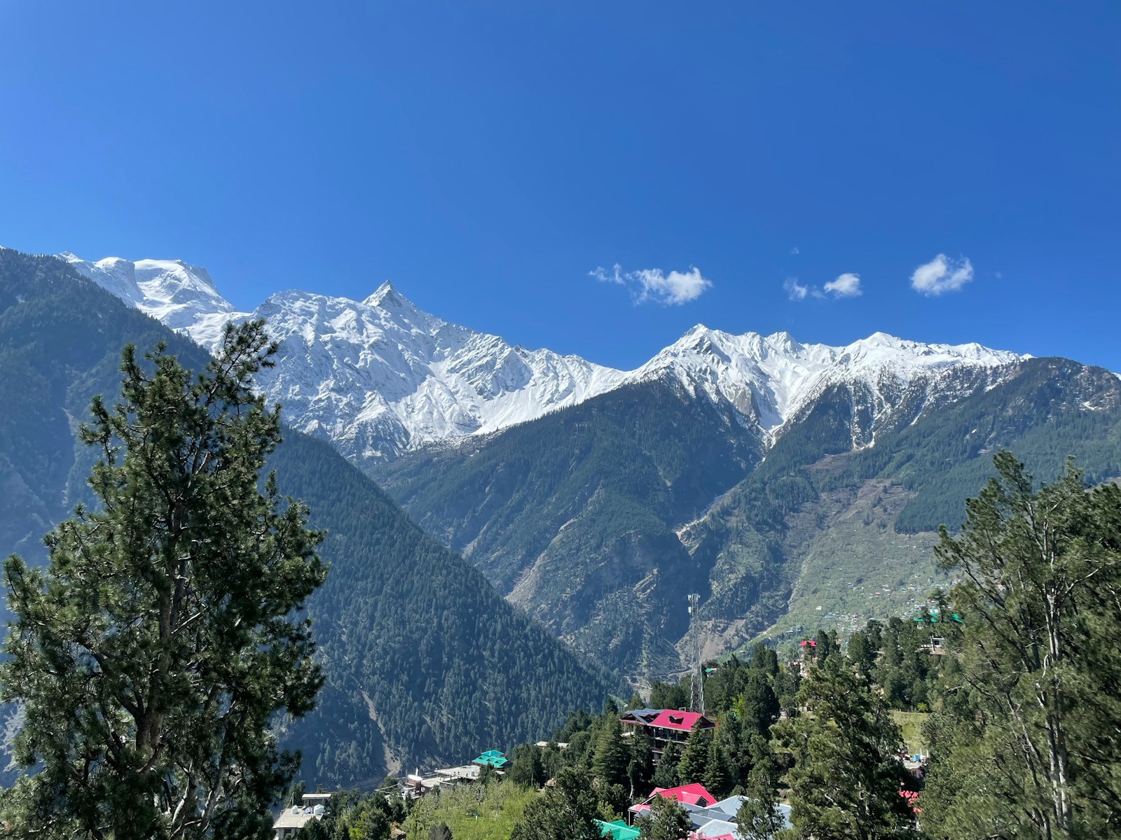
Kinnaur District
Kinnaur is both a region of highland valleys and a district created on 1 May 1960. The two are not interchangeable. The Sutlej, Baspa, and Spiti valleys organize its geography, while political authority, speech, religious institutions, architecture, and administration varied by locality and changed over time.
The evidence is uneven. Local and dynastic traditions connect Kamru with Bushahr rulership; administrative records describe colonial and post-independence change; and modern official histories organize earlier material retrospectively. A credible account keeps tradition, institutional record, and later synthesis separate. It also follows the district administration’s own warning that Kinnauras do not constitute a homogeneous group.
Key Takeaways
- Early Kinnaur cannot be reduced to legend or a complete dynasty list. Official history warns that authentic early records are scarce and that many names and episodes are legendary or mythological.
- The district contains multiple historical orientations. Sutlej, Baspa, Spiti-facing, and other localities should not be treated as one timeless political, religious, or linguistic unit.
- Kamru and Bushahr are central but not all-encompassing. Dynastic traditions and later records connect them to regional rulership without establishing identical government across every valley.
- The Hindustan–Tibet road requires precise claims. Official evidence establishes its route through the Sutlej corridor towards Shipki La, not a superlative age, single origin date, or complete exchange history.
- Frontier history changed before and after independence. Former Bushahr territory passed through Chini tehsil and Mahasu administration before the 1960 reorganization.
- Kinnaur’s district formation predates the 1962 war. Border-administration and cultural considerations appear in official explanations, but the later conflict cannot have caused a district created two years earlier.
Valleys, Routes, and Uneven Historical Experience
The Sutlej is the major east–west corridor through Kinnaur, joined by the Baspa and by the Spiti near Khab. The district’s official overview uses these valleys to explain its geography and the line of the old Hindustan–Tibet road towards the Shipki La area. Geography shaped possible movement, but it did not dictate one shared history.
Communities lower along the Sutlej, in the Baspa valley, around the middle valleys, and towards the higher rain-shadow areas lived at different distances from roads, administrative centres, and monastic or temple institutions. A district-level route cannot be assumed to have held the same importance for every village.
The district culture page describes lower, middle, and upper zones and explicitly rejects homogeneity. That framework can help a general reader notice variation, but it should not harden into three timeless ethnic blocs. Boundaries among speech forms, religious affiliations, architecture, marriage networks, and local political institutions do not necessarily align with administrative zones.
“Kinnaur” therefore names a useful region and a modern district, not proof that all residents inherited the same language, ritual system, or frontier experience.
The Limits of Early Evidence
The official district history notes that authentic records for early Kinnaur are scarce and that many references are legendary or mythological. This warning is preferable to a confident ancient chronology assembled from later stories. Without an inspected report, stable access, secure context, and chronology, specific material finds cannot responsibly be assigned to a dynasty, migration, language, or present-day community.
The name Kinnaur is often connected to the Kinnaras of Sanskrit literature. Literary associations have shaped identity and outside representation, but a similar name does not demonstrate direct biological or cultural descent. Textual figures and modern populations belong to different evidence categories.
Documents and inscriptions can illuminate political relationships only when their provenance, text, and scholarly reading are verified. Without that verification, an exact treaty date or a claim that one document founded a later fair cannot be established.
Kamru, Bushahr, and Local Political Traditions
Official and gazetteer narratives connect Kamru in the Baspa valley with the origins of Bushahr rulership. The state later centred its court at Rampur, downstream on the Sutlej, while much of present Kinnaur remained within its wider political sphere. These traditions place Kinnaur near the heart of Bushahr’s remembered origins, but that does not mean every valley was governed identically in every period.
Highland politics involved overlapping claims and institutions. Rulers asserted authority, while village and deity institutions could express locally grounded political forms. Arik Moran’s study of Bushahr describes a frontier kingdom negotiating British interests rather than simply receiving orders from above.
Kamru’s dynastic importance should not turn the Baspa valley into a template for the entire district. Relationships beyond the present boundary require their own claim-specific chronology and evidence rather than one permanent outside “influence.”
The 1971 Kinnaur gazetteer remains a valuable post-formation compilation of traditions, institutions, geography, and communications. It was produced soon after the district’s creation and inherits older administrative and ethnographic categories. Its account is best read alongside other official records and later scholarship rather than as a final early history.
Reading the Historic Road Carefully
The district overview places the old Hindustan–Tibet road along the Sutlej corridor towards Shipki La. That establishes a historical route, not a complete commodity list, a permanently open channel, or equal participation by every locality.
Calling the Hindustan–Tibet road one of the world’s oldest roads would blur the distinction between a mountain corridor and an engineered road. The official district overview establishes the route but not such a superlative or a single origin date, so the evidence supports neither conclusion.
A district-level account cannot assume that a route near Shipki La structured life in the same way in Baspa villages, lower Sutlej settlements, and more remote side valleys. Route geography alone also cannot establish one uniform religious or cultural synthesis; local institutions and practices require their own histories.
Bushahr Under Colonial Paramountcy
British expansion brought Bushahr into a changing framework of paramountcy. Moran’s work is useful because it resists describing the princely state as a passive administrative shell: rulers and locally grounded institutions negotiated colonial interests rather than simply receiving orders from above.
Colonial and later gazetteer records preserve valuable detail but carry the categories and goals of administration. Their descriptions of communities should not be repeated as timeless ethnography or treated as a complete account of local political life.
The frontier’s administrative meaning changed under imperial jurisdiction and again after independence. Present permit or access rules cannot be inferred from that historical sequence, and a fuller social history requires village-level evidence beyond administrative summaries.
From Bushahr to Chini and Mahasu Administration
After the integration of princely states, former Bushahr territory entered the administration of Himachal Pradesh. Official Kinnaur histories describe the region through Chini tehsil of Mahasu district, with Rampur-linked areas also relevant to the later reorganization.
This was not simply an old territory receiving a new label. Princely jurisdiction, tehsil boundaries, and district boundaries organize space differently. Administrative headquarters and reporting relationships changed, while local networks continued across those lines. “Chini,” “Bushahr,” “Mahasu,” and “Kinnaur” therefore refer to overlapping but non-identical historical geographies.
The years after independence also changed the political significance of the frontier. National border administration added new priorities to older concerns with routes and revenue. Official institutional accounts cite border-administration needs and ethnic or cultural considerations in explaining the eventual district. Those are state rationales, not a complete account of how residents understood reorganization.
Kinnaur District, 1 May 1960
Kinnaur became a separate district on 1 May 1960. The eCourts institutional history describes a reorganization involving areas formerly associated with Chini and parts of Rampur administration. The exact boundary was thus constructed through modern government decisions; it was not simply the rediscovery of an unchanged ancient Kinnaur.
The 1961 Census district handbook provides the earliest census-era portrait after formation. Its categories are useful for understanding how the new district was counted and administered. They should not be converted into timeless identities or proof that one district total describes every language or community.
Because the district was created in 1960, the 1962 Sino-Indian War cannot have caused its formation. Border concerns may belong to the official administrative context, but the later conflict cannot explain an earlier decision.
District formation created a common administrative unit and new institutions. It did not erase older valley and regional orientations or the importance of local religious and political centres. Administrative unity and historical plurality can both be true.
A Plural Historical Inheritance
Kinnaur’s history is best understood as movement among scales. Limited early evidence does not yield a district-wide ancient identity. Kamru and Bushahr traditions illuminate rulership without governing every locality’s memory. The official road record establishes Sutlej–Shipki route geography without supplying a complete exchange history. Colonial paramountcy changed Bushahr’s political setting, and post-independence reorganization made a district from several administrative and historical geographies.
The available sources also have boundaries. The district pages are public-history syntheses. The gazetteer is an early post-formation administrative compilation. Census handbooks classify a population for particular dates. Scholarship on Bushahr’s political ecology cannot stand in for every Kinnaur village.
Those limits argue against a smooth civilizational narrative or a single cultural label. They support a more precise conclusion: modern Kinnaur brings diverse valleys and communities into one district, while their languages, religious institutions, routes, and historical memories remain varied. The district boundary is an important event in that history, not the beginning or endpoint of it.
Frequently Asked Questions
Is Kinnaur one historically homogeneous cultural region?
No. The district administration itself emphasizes diversity, and historical experience varies among Sutlej, Baspa, Spiti-facing, and other localities. Administrative lower, middle, and upper zones are useful orientation, not proof of fixed linguistic, religious, or ethnic blocs.
Are modern Kinnauras the Kinnaras described in ancient literature?
The resemblance is an important naming and identity tradition, but literary Kinnaras cannot be equated directly with present communities without evidence. The official history page also warns that early references are often legendary or mythological.
What does the official record establish about the Hindustan–Tibet road?
The district overview traces the old road through the Sutlej corridor towards Shipki La. That establishes route geography, not a single origin date, a complete history of exchange, or equal importance for every Kinnaur locality.
When did Kinnaur become a district?
Kinnaur became a separate district on 1 May 1960, drawing on areas associated with Chini and Rampur administration. This predates the 1962 Sino-Indian War, so the district was not created in response to that later conflict.
Does this history explain current permits or border access?
No. Historical frontier controls and administrative change do not establish present permit, road, trade, or border rules. Current access must be checked separately with the competent authorities and is intentionally outside this history article.