Kangra District
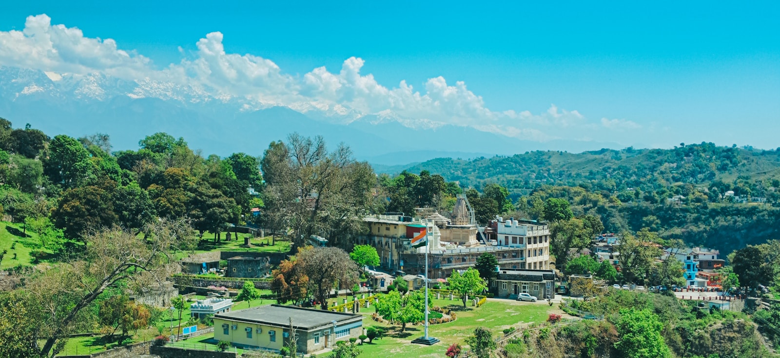
Kangra District
Overview
Kangra is the most populous district of Himachal Pradesh and one of the most historically consequential regions in the entire western Himalaya. Spread across 5,739 square kilometres along the southern flanks of the Dhauladhar Range, the district is home to over 1.5 million people (as per the 2011 Census of India), making it a demographic and cultural anchor for the state. Its administrative headquarters are at Dharamshala, which has also served as the winter capital of Himachal Pradesh and, since 1960, as the seat of the 14th Dalai Lama and the Tibetan government-in-exile.
The district is defined by the wide, fertile Kangra Valley, drained primarily by the Beas River and its tributaries, and bounded to the north by the snow-capped Dhauladhar — whose name translates to “White Range.” Within this single district one finds the dense forests and tea estates of Palampur, the ancient rock-cut temples of Masroor, the flame shrine of Jawalamukhi, the Katoch dynasty’s stronghold at Kangra Fort, and the Tibetan cultural quarter of McLeod Ganj. Kangra’s layered identity — Hindu pilgrimage centre, Rajput royal domain, colonial tea frontier, miniature-painting atelier, and modern Tibetan diaspora hub — makes it a district of extraordinary breadth.
Background
Early and Medieval History
Kangra’s recorded history reaches deep into antiquity. The region was known in classical texts as Trigarta, a kingdom mentioned in the Mahabharata, and its ruling Katoch dynasty claims a lineage stretching back thousands of years — making it one of the oldest continuously documented royal houses in India. The town of Kangra itself was historically called Nagarkot (“Fort of the Serpent”), a name that referenced both the Kangra Fort and the serpent deity associated with the founding legend of the Katoch clan.
The Kangra Fort, situated on a steep scarp overlooking the confluence of the Banganga and Majhi streams, is the district’s most enduring monument. Though the precise date of its original construction is debated, surviving structural remains inside the fort — Jain and Brahminical temples — have been dated to approximately the 9th–10th centuries CE. The fort withstood numerous sieges over the centuries, including attacks by Mahmud of Ghazni (in 1009, according to tradition), the Mughals under Jahangir (1621), and later the Sikhs under Maharaja Ranjit Singh (1809). Its resilience earned it a reputation as one of the most impregnable strongholds in northern India.
The Colonial Era and the 1905 Earthquake
After the Anglo-Sikh wars, the British assumed control of the Kangra Valley in the mid-19th century. They established Dharamshala as the district’s administrative headquarters in 1855, drawn to its salubrious climate. In 1849, a colonial surveyor named Jameson conducted a feasibility study that found the Kangra Valley suitable for tea cultivation; he introduced China-variety tea plants, thereby launching a tea industry that continues to define the Palampur area today. Kangra tea eventually earned a Geographical Indication (GI) tag, recognising its distinctive character.
The single most devastating event in the district’s modern history was the Kangra earthquake of 4 April 1905. With a surface-wave magnitude of 7.8, the quake struck in the early hours of the morning and killed more than 20,000 people across the Kangra Valley. Towns including Kangra, Dharamshala, and Palampur were largely reduced to rubble. The Kangra Fort, already centuries old, was badly damaged. The earthquake is among the most lethal seismic events in Indian history and remains a reference point for Himalayan seismic-risk studies today.
The Tibetan Community
In 1959, the 14th Dalai Lama, Tenzin Gyatso, fled Tibet and crossed into India. The following year, 1960, the Government of India allocated land at McLeod Ganj — a suburb of Dharamshala — for the Dalai Lama’s residence and the newly formed Central Tibetan Administration. McLeod Ganj soon became known as “Little Lhasa” or, in Tibetan shorthand, “Dhasa.” Today, approximately 8,000 Tibetans live across the settlements of the McLeod Ganj area, and the Tsuglagkhang Complex — the Dalai Lama’s temple and official residence — draws pilgrims and visitors from around the world. The Tibetan presence has profoundly shaped modern Kangra, adding Buddhist monasteries, schools, handicrafts, and a distinctive culinary scene to the district’s cultural fabric.
Key Features
Geography and Climate
Kangra’s landscape varies dramatically. The lowlands around the Beas — around 400–600 metres in elevation — are warm, fertile, and intensively farmed. Moving north, the terrain rises through the Dhauladhar foothills toward crests that exceed 4,000 metres. This vertical gradient produces an extraordinary range of microclimates: subtropical in the valley floor, cool and temperate around Palampur and Dharamshala, and alpine on the high ridges. The Dhauladhar — which rises almost sheer above the Kangra Valley in places — is one of the most photogenic features of the western Himalaya, visible from many points across the district.
Temples and Pilgrimage
Kangra is one of the most sacred landscapes in Himachal, home to several prominent Hindu shrines:
- Bajreshri Devi (Vajreshwari) Temple, Kangra town — dedicated to the goddess who, according to legend, emerged from the divine fire after a demon’s defeat.
- Jawalamukhi Temple — one of the 51 Shakti Peethas, where the goddess is worshipped in the form of eternally burning natural gas flames rather than an idol.
- Baijnath Temple — a 13th-century Shiva temple renowned for its Nagara-style architecture and inscriptions, located in the town of Baijnath.
- Chamunda Devi Temple — perched above the Baner stream, dedicated to the fierce form of Durga.
- Masroor Rock-Cut Temple — a monolithic complex of 15 temples carved from a single sandstone outcrop, often called the “Himalayan Ellora,” dated to approximately the 8th–10th centuries.
These sites make Kangra a major node on the Himachali pilgrimage circuit.
Kangra Painting
The district gave its name to one of the finest traditions of Indian miniature painting. The Kangra school of Pahari painting emerged in the mid-18th century, succeeding the earlier, bolder Basohli style. Under the patronage of Raja Sansar Chand of Kangra (ruled 1775–1823), artists refined a lyrical, delicate aesthetic — characterised by graceful lines, subtle colour palettes, and depictions of Krishna, Radha, and scenes from the Gita Govinda. Paintings were executed on Sialkoti paper, a handmade surface, and frequently incorporated natural pigments. The Kangra style remains a touchstone for Indian art-historical scholarship and continues to inspire contemporary artists in the region. (Wikipedia — Pahari painting)
Tea and Agriculture
The tea gardens around Palampur are the legacy of Jameson’s 1849 experiment. Kangra tea, grown on slopes up to 1,500 metres, produces both black and green varieties noted for their light colour and delicate aroma. The industry declined through the 20th century but has seen renewed interest following the GI tag recognition. Beyond tea, the district is a major producer of rice, wheat, maize, and horticultural crops such as mango, lychee, and citrus.
Dharamshala and McLeod Ganj
As the seat of the Central Tibetan Administration, Dharamshala carries a dual identity: it is at once a Himachali district headquarters and a global symbol of the Tibetan freedom movement. McLeod Ganj, the upper suburb, hosts the Tsuglagkhang Complex (the Dalai Lama’s temple), the Namgyal Monastery, the Library of Tibetan Works and Archives, and numerous organisations serving the exile community. The area has become a hub for Buddhist study, volunteering, and Himalayan trekking — including routes to Triund and the Dhauladhar — attracting an international community of visitors.
FAQ
What should readers know first about Kangra District?
Kangra is the most populous district of Himachal Pradesh and a crossroads of Himalayan civilisations. It combines an ancient Hindu pilgrimage landscape, the Rajput legacy of the Katoch dynasty, the ruins of a devastating 1905 earthquake, a colonial-era tea industry, and the modern Tibetan exile community centred at McLeod Ganj. Its administrative headquarters, Dharamshala, also serves as the winter capital of the state.
Why is Kangra Fort considered historically important?
Kangra Fort is among the oldest surviving forts in India, with structural remains dating to roughly the 9th–10th centuries CE and a Katoch dynastic lineage that traces back to the ancient kingdom of Trigarta. It survived attacks by Mahmud of Ghazni, the Mughals under Jahangir, and the Sikhs under Ranjit Singh, though it was badly damaged in the 1905 earthquake. The site, still owned by the Katoch family, remains a potent symbol of regional sovereignty.
What is the significance of the Tibetan community in Kangra?
After the Dalai Lama’s exile in 1959, McLeod Ganj became the headquarters of the Central Tibetan Administration. The Tibetan exile community — roughly 8,000 strong in the McLeod Ganj area — has established monasteries, schools, cultural institutions, and a vibrant handicrafts economy. This presence has transformed the upper Dharamshala region into a uniquely cosmopolitan corner of Himachal and an internationally recognised site of Buddhist learning.
What is Kangra tea, and why does it matter?
Kangra tea was established in 1849 when a colonial surveyor, Jameson, introduced China-variety tea plants to the valley around Palampur. Grown at elevations of up to 1,500 metres, it is known for its light colour and delicate aroma. The tea has received a Geographical Indication (GI) tag, protecting its regional identity and supporting efforts to revive the industry after decades of decline.
Where can readers learn more about Kangra District?
Authoritative sources include the Kangra district Wikipedia article, the Britannica entry on Kangra, the District Census Handbook for Kangra (Census of India 2011), and the McLeod Ganj Wikipedia article for the Tibetan community’s history. The 1905 Kangra earthquake Wikipedia article provides a detailed account of the district’s defining natural disaster.